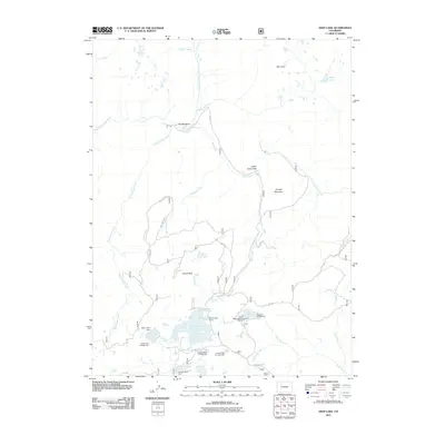
2011 Map of Deep Lake
USGS Topo · Published 2011About this map
Deep Lake and its surrounding water network characterize this high-altitude landscape of the Colorado Rockies as it appeared in the early 21st century. The terrain is defined by a series of reservoirs and natural basins, including Heart Lake Reservoir, Bison Lake, and Supply Basin Reservoir, many of which are managed via structures like the Heart Lake Dam and Bison Lake Dam. This high-country environment is structured for recreational use, shown through a series of managed sites such as Bison Lake Campground, Deep Lake Campground, and the curiously named Klines Folly Campground.
Find a feature on this map
38 named features on this map. Tap any name to fly to it.
Don’t see what you’re looking for? This feature index may not catch every label — zoom into the map to look around manually.
Map Details
Editions of this 2011 Deep Lake Map
This is the sole edition of this map. No revisions or reprints were ever made.
Other maps of this area

1927 · Glenwood Springs
USGS Topo · 1:125,000

1930 · Glenwood Springs
USGS Topo · 1:125,000

1957 · Leadville
USGS Topo · 1:250,000

1959 · Leadville
USGS Topo · 1:250,000

1960 · Leadville
USGS Topo · 1:250,000

1962 · Leadville
USGS Topo · 1:250,000

1964 · Leadville
USGS Topo · 1:250,000
1974 · Broken Rib Creek
USGS Topo · 1:24,000
1974 · Carbonate
USGS Topo · 1:24,000
1974 · Adams Lake
USGS Topo · 1:24,000