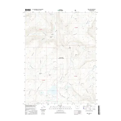
2016 Map of Deep Lake
USGS Topo · Published 2016About this map
White River National Forest defines this high-elevation landscape in Garfield County, dominated by the expansive White River Plateau and the prominent Blair Mountain. This 2016 survey documents a complex network of water resources and trails, centered around Deep Lake and the managed waters of Heart Lake Reservoir and Supply Basin Reservoir. The terrain is marked by significant elevation changes, from the depths of South Fork Canyon to the summits of Hunns Peak and Triangle Mtn. Historically significant routes like the Wagon Wheel Trail and Trappers Lake Trail cross the plateau, linking various basins. This map provides a clear record of the area's hydrology, including S Fork White River and White Owl Cr, alongside named landmarks such as The Meadows and Indian Camp Pass.
Find a feature on this map
43 named features on this map. Tap any name to fly to it.
Don’t see what you’re looking for? This feature index may not catch every label — zoom into the map to look around manually.
Map Details
Editions of this 2016 Deep Lake Map
This is the sole edition of this map. No revisions or reprints were ever made.
Other maps of this area

1927 · Glenwood Springs
USGS Topo · 1:125,000

1930 · Glenwood Springs
USGS Topo · 1:125,000

1957 · Leadville
USGS Topo · 1:250,000

1959 · Leadville
USGS Topo · 1:250,000

1960 · Leadville
USGS Topo · 1:250,000

1962 · Leadville
USGS Topo · 1:250,000

1964 · Leadville
USGS Topo · 1:250,000
1974 · Broken Rib Creek
USGS Topo · 1:24,000
1974 · Carbonate
USGS Topo · 1:24,000
1974 · Adams Lake
USGS Topo · 1:24,000