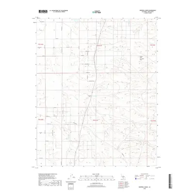
2018 Map of Deepwell Ranch
USGS Topo · Published 2018About this map
Agricultural development defines this portion of the Central Valley within the San Joaquin Valley. The landscape is dominated by a rigid grid of namesake-labeled roads that reflect the regional citrus and nut industry, including Orange Grove Ave, Pistachio Rd, Navel Ave, Grapefruit St, Tangerine St, and Lemon St. These labels provide a literal map of the orchard crops that sustained the local economy in the early 21st century.
Find a feature on this map
38 named features on this map. Tap any name to fly to it.
Don’t see what you’re looking for? This feature index may not catch every label — zoom into the map to look around manually.
Map Details
Editions of this 2018 Deepwell Ranch Map
This is the sole edition of this map. No revisions or reprints were ever made.
Other maps of this area

1906 · Bakersfield
USGS Topo · 1:62,500

1926 · Quincy School
USGS Topo · 1:31,680

1927 · McFarland
USGS Topo · 1:31,680

1929 · Delano
USGS Topo · 1:31,680

1929 · Richgrove
USGS Topo · 1:31,680

1929 · Quincy School
USGS Topo · 1:31,680

1930 · McFarland
USGS Topo · 1:31,680

1930 · Famoso
USGS Topo · 1:31,680

1931 · Deepwell Ranch
USGS Topo · 1:31,680

1932 · North of Oildale
USGS Topo · 1:31,680