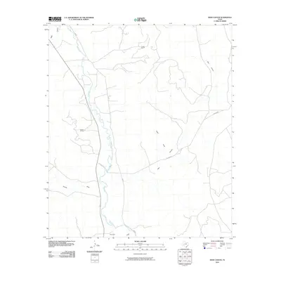
2010 Map of Deer Canyon
USGS Topo · Published 2010About this map
The Pecos River carves a winding path through this West Texas landscape, serving as the primary geographical focus. This area in Pecos County is defined by its industrial activity and stark drainage patterns, where the presence of the Noelke Oil Field and the Millard Oil Field indicate a terrain heavily utilized for petroleum extraction. These energy resources are connected by a network of functional transit routes, including River Rd and Texas Rock Rd. The topography is further shaped by several significant erosional features that channel toward the river valley, most notably Deer Canyon, Eagle Draw, and Sixmile Draw. These named draws and canyons illustrate the natural drainage systems that define the high desert plains between the river and the surrounding uplands.
Find a feature on this map
11 named features on this map. Tap any name to fly to it.
Don’t see what you’re looking for? This feature index may not catch every label — zoom into the map to look around manually.
Map Details
Editions of this 2010 Deer Canyon Map
This is the sole edition of this map. No revisions or reprints were ever made.
Other maps of this area

1929 · Sheffield
USGS Topo · 1:125,000

1954 · Sonora
USGS Topo · 1:250,000

1958 · Sonora
USGS Topo · 1:250,000

1967 · Twelvemile Camp
USGS Topo · 1:24,000

1967 · Divide Country
USGS Topo · 1:24,000

1967 · Sheffield NW
USGS Topo · 1:24,000

1967 · Deer Canyon
USGS Topo · 1:24,000

1967 · Fort Lancaster
USGS Topo · 1:24,000
1967 · Iraan
USGS Topo · 1:24,000
1967 · Owens Creek SW
USGS Topo · 1:24,000