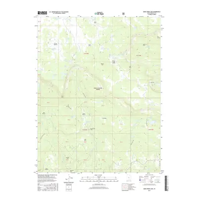
2017 Map of Deer Creek Lake
USGS Topo · Published 2017About this map
Dixie National Forest defines the high-altitude landscape of this Garfield County map, centered on the complex drainage systems of Boulder Mtn. The terrain is marked by a dense concentration of alpine lakes and reservoirs, including the namesake Deer Creek Lake and Moosman Reservoir. These water sources supported seasonal livestock grazing operations, as evidenced by named clearings like Kings Pasture, Baker Pasture, and Haws Pasture.
Find a feature on this map
88 named features on this map. Tap any name to fly to it.
Don’t see what you’re looking for? This feature index may not catch every label — zoom into the map to look around manually.
Map Details
Editions of this 2017 Deer Creek Lake Map
This is the sole edition of this map. No revisions or reprints were ever made.
Other maps of this area

1885 · Fish Lake
USGS Topo · 1:250,000

1886 · Escalante
USGS Topo · 1:250,000

1896 · Fish Lake
USGS Topo · 1:250,000

1952 · Notom 3 SW
USGS Topo · 1:24,000

1952 · Notom 3 NW
USGS Topo · 1:24,000

1952 · Notom 3 SE
USGS Topo · 1:24,000

1952 · Notom 3 NE
USGS Topo · 1:24,000

1952 · Grover
USGS Topo · 1:62,500

1953 · Circle Cliffs 2 NE
USGS Topo · 1:24,000

1953 · Loa 4 NE
USGS Topo · 1:24,000