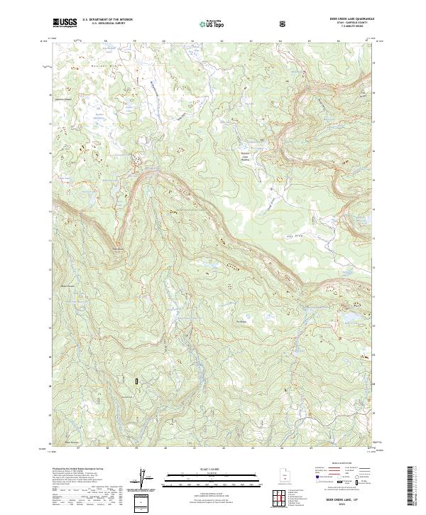
2023 Map of Deer Creek Lake
USGS Topo · Published 2023About this map
The high-elevation tablelands of the Aquarius Plateau dominate this portion of the Dixie National Forest, where a complex network of seasonal water and irrigation infrastructure supports local land use. Significant reservoirs including West Fork Reservoir, Kings Pasture Reservoir, and Moosman Reservoir are vital features of the landscape, managing the flow of the West Fork Boulder Creek and East Fork Boulder Creek. This high-country drainage system is punctuated by numerous natural water bodies such as Crater Lake, Big Lake, and the cluster of East Boulder Lakes.
Find a feature on this map
68 named features on this map. Tap any name to fly to it.
Don’t see what you’re looking for? This feature index may not catch every label — zoom into the map to look around manually.
Map Details
Editions of this 2023 Deer Creek Lake Map
This is the sole edition of this map. No revisions or reprints were ever made.
Other maps of this area

1885 · Fish Lake
USGS Topo · 1:250,000

1886 · Escalante
USGS Topo · 1:250,000

1896 · Fish Lake
USGS Topo · 1:250,000

1952 · Notom 3 SW
USGS Topo · 1:24,000

1952 · Notom 3 NW
USGS Topo · 1:24,000

1952 · Notom 3 SE
USGS Topo · 1:24,000

1952 · Notom 3 NE
USGS Topo · 1:24,000

1952 · Grover
USGS Topo · 1:62,500

1953 · Circle Cliffs 2 NE
USGS Topo · 1:24,000

1953 · Loa 4 NE
USGS Topo · 1:24,000