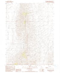
1990 Map of Deer Creek Peak
USGS Topo · Published 1990About this map
The Jackson Mountains dominate this 1990 survey of Humboldt County, rising sharply above the eastern margin of the Black Rock Desert. This arid landscape is defined by its vital water sources and mineral potential, with numerous labels for Spring and Stock Pond Spring scattered across the high country. Resource extraction is evident through several marked Mine sites and Prospect locations, as well as Gravel Pits on the lower slopes. The human footprint is sparse but specific, centered on the Bottle Creek Ranch and the Poorman Spring area to the southeast. Waterways like Deer Creek, Hoppy Creek, and Willow Springs provide the primary geographic markers through the rugged interior, while a Transmission Line and a system of trails and unimproved roads trace the movement of people through this basin and range environment.
Find a feature on this map
17 named features on this map. Tap any name to fly to it.
Don’t see what you’re looking for? This feature index may not catch every label — zoom into the map to look around manually.
Map Details
Editions of this 1990 Deer Creek Peak Map
This is the sole edition of this map. No revisions or reprints were ever made.
Other maps of this area

1886 · Disaster
USGS Topo · 1:250,000

1893 · Disaster
USGS Topo · 1:250,000

1954 · Vya
USGS Topo · 1:250,000

1958 · Vya
USGS Topo · 1:250,000

1961 · Quinn River Crossing
USGS Topo · 1:62,500

1961 · Bottle Creek
USGS Topo · 1:62,500

1962 · Vya
USGS Topo · 1:250,000

1965 · Duffer Peak
USGS Topo · 1:62,500

1972 · Deer Creek Slough
USGS Topo · 1:24,000

1972 · Hobo Canyon
USGS Topo · 1:24,000