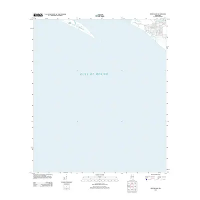
2012 Map of Deer Island
USGS Topo · Published 2012About this map
Deer Island and the open waters of the Gulf of Mexico dominate this coastal survey, which documents the shoreline just east of Biloxi. The long, narrow profile of the island is bisected by Grand Bayou, a small interior waterway. On the mainland to the northeast, a dense residential street grid appears along the coast, defined by thoroughfares such as Point Aux Chenes Rd and Seacliff Blvd. This layout shows a community oriented toward the sound, with bird-named streets like Meadow Lark Ave and Warbler Ave filling the blocks between the shore and the inland marshes. The map captures the interface between these developed coastal neighborhoods and the undeveloped barrier island landscape as it existed in the early 21st century.
Find a feature on this map
24 named features on this map. Tap any name to fly to it.
Don’t see what you’re looking for? This feature index may not catch every label — zoom into the map to look around manually.
Map Details
Editions of this 2012 Deer Island Map
This is the sole edition of this map. No revisions or reprints were ever made.
Other maps of this area

1941 · Horn Island
USGS Topo · 1:62,500

1942 · Horn Island
USGS Topo · 1:62,500

1943 · Pascagoula
USGS Topo · 1:62,500

1950 · Dog Keys Pass
USGS Topo · 1:24,000

1950 · Ship Island
USGS Topo · 1:24,000

1953 · Mobile
USGS Topo · 1:250,000

1954 · Ocean Springs
USGS Topo · 1:24,000

1954 · Biloxi
USGS Topo · 1:24,000

1954 · Deer Island
USGS Topo · 1:24,000

1954 · Biloxi
USGS Topo · 1:62,500