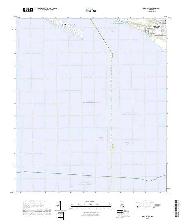
2024 Map of Deer Island
USGS Topo · Published 2024About this map
Deer Island stretches across the northern portion of this coastal sheet, shielding the mainland from the open waters of the Gulf of Mexico. On the Mississippi mainland, the residential development of Gulf Park Estates is documented in detail, featuring a grid of named streets such as Mermaid Ave and Lake Mars Ave that extend toward the shore of Biloxi Bay. The map highlights the complex maritime boundary between Harrison and Jackson Counties, as it winds through the Mississippi Sound. Protected lands of the Gulf Islands National Seashore encompass both the northern and southern reaches of the quadrangle. This contemporary survey captures the intricate relationship between the growing suburban footprint at the edge of Biloxi and the managed wilderness of the barrier islands and the Intracoastal Waterway.
Find a feature on this map
28 named features on this map. Tap any name to fly to it.
Don’t see what you’re looking for? This feature index may not catch every label — zoom into the map to look around manually.
Map Details
Editions of this 2024 Deer Island Map
This is the sole edition of this map. No revisions or reprints were ever made.
Other maps of this area

1941 · Horn Island
USGS Topo · 1:62,500

1942 · Horn Island
USGS Topo · 1:62,500

1943 · Pascagoula
USGS Topo · 1:62,500

1950 · Dog Keys Pass
USGS Topo · 1:24,000

1950 · Ship Island
USGS Topo · 1:24,000

1953 · Mobile
USGS Topo · 1:250,000

1954 · Ocean Springs
USGS Topo · 1:24,000

1954 · Biloxi
USGS Topo · 1:24,000

1954 · Deer Island
USGS Topo · 1:24,000

1954 · Biloxi
USGS Topo · 1:62,500