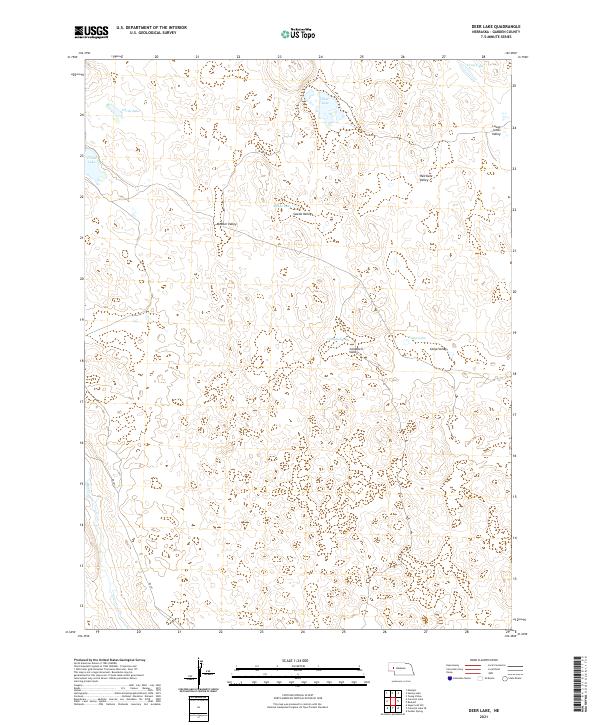
2021 Map of Deer Lake
USGS Topo · Published 2021About this map
Deer Lake and a series of distinct water bodies characterize this remote section of Garden County, where the Sandhills landscape is defined by its depressions and valleys rather than significant settlement. The terrain is marked by numerous family-named landmarks including Meeker Valley, Swede Valley, and Red Kate Valley, suggesting a history of local land use tied to these specific topographical pockets. Water is the primary feature of interest here, with Crane Lake and Christ Lake appearing in the west, while Campbell Lake and Camp Lake occupy the central and eastern portions. Blue Creek enters the frame in the southwest corner, while the solitary RD 181 provides the only significant modern thoroughfare through this sparsely populated cattle country. The arrangement of these lakes and valleys reflects the unique hydrology of the region, where groundwater often meets the surface in low-lying interdunal basins.
Find a feature on this map
21 named features on this map. Tap any name to fly to it.
Don’t see what you’re looking for? This feature index may not catch every label — zoom into the map to look around manually.
Map Details
Editions of this 2021 Deer Lake Map
This is the sole edition of this map. No revisions or reprints were ever made.
Other maps of this area

1949 · Mumper
USGS Topo · 1:62,500

1949 · Rackett
USGS Topo · 1:62,500

1950 · Crescent Lake
USGS Topo · 1:62,500

1950 · Longfellow Lake
USGS Topo · 1:62,500

1951 · Rackett
USGS Topo · 1:62,500

1954 · Scottsbluff
USGS Topo · 1:250,000

1958 · Scottsbluff
USGS Topo · 1:250,000

1985 · Crescent Lake
USGS Topo · 1:100,000
1986 · Gusher Spring
USGS Topo · 1:24,000
1986 · Sugar Loaf Hill
USGS Topo · 1:24,000