
1985 Map of Crescent Lake
USGS Topo · Published 1986About this map
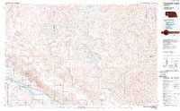
Crescent Lake National Wildlife Refuge dominates the central landscape of this 1980s Garden County survey, revealing a complex network of wetlands and shallow basins characteristic of the Nebraska Sandhills. This environment is defined by an intricate cluster of water bodies including Blue Lake, Island Lake, and Hackberry Lake, alongside smaller features like the Flowing Well. The hydrography here is distinct, with numerous named lakes such as Smith Lake, Rush Lake, and Crescent Lake providing critical habitat in an otherwise arid-appearing terrain.
Find a feature on this map
178 named features on this map. Tap any name to fly to it.
Don’t see what you’re looking for? This feature index may not catch every label — zoom into the map to look around manually.
Map Details
Editions of this 1985 Crescent Lake Map
2 editions found
Other maps of this area

1896 · Browns Creek
USGS Topo · 1:125,000

1897 · Ogallala
USGS Topo · 1:125,000

1898 · Camp Clarke
USGS Topo · 1:125,000

1899 · Browns Creek
USGS Topo · 1:125,000

1899 · Sidney
USGS Topo · 1:125,000

1900 · Chappell
USGS Topo · 1:125,000

1900 · Ogallala
USGS Topo · 1:125,000

1947 · Alliance
USGS Topo · 1:24,000

1947 · Bronco Lake
USGS Topo · 1:24,000

1948 · Hemingford 4 SE
USGS Topo · 1:24,000