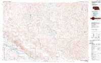
1985 Map of Crescent Lake
USGS Topo · Published 1989About this map
The Crescent Lake National Wildlife Refuge dominates this mid-1980s landscape, illustrating the intricate wetland ecosystem of the Nebraska Sandhills. The map reveals a dense concentration of small, high-plains lakes including Blue Lake, Island Lake, and Hackberry Lake, set against a backdrop of named valleys and hills like Sugar Loaf Hill. In the southwest corner, the North Platte River provides a stark contrast to the dune-formed topography above, followed closely by the Union Pacific railroad corridor and U.S. 26.
Find a feature on this map
84 named features on this map. Tap any name to fly to it.
Don’t see what you’re looking for? This feature index may not catch every label — zoom into the map to look around manually.
Map Details
Editions of this 1985 Crescent Lake Map
2 editions found

Other maps of this area

1896 · Browns Creek
USGS Topo · 1:125,000

1897 · Ogallala
USGS Topo · 1:125,000

1898 · Camp Clarke
USGS Topo · 1:125,000

1899 · Browns Creek
USGS Topo · 1:125,000

1899 · Sidney
USGS Topo · 1:125,000

1900 · Chappell
USGS Topo · 1:125,000

1900 · Ogallala
USGS Topo · 1:125,000

1947 · Alliance
USGS Topo · 1:24,000

1947 · Bronco Lake
USGS Topo · 1:24,000

1948 · Hemingford 4 SE
USGS Topo · 1:24,000