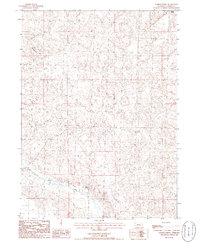
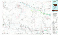
1986 Map of Gusher Spring
USGS Topo · Published 1986About this map
Wildhorse Hill rises above the sandhills of Garden County in this mid-1980s topographic survey. The landscape is defined by the winding course of Blue Creek and the presence of Gusher Spring, reflecting the vital importance of water sources in this arid Nebraska region. The map captures a largely open ranching environment where few structures exist, save for a solitary Corral and a network of unimproved roads and trails that traverse the undulating terrain toward Green Valley. This 1986 provisional edition, based on earlier aerial photography, provides a clear view of the natural hydrology and land use patterns before modern pivots or significant development altered the classic Sandhills profile.
Find a feature on this map
5 named features on this map. Tap any name to fly to it.
Don’t see what you’re looking for? This feature index may not catch every label — zoom into the map to look around manually.
Map Details
Editions of this 1986 Gusher Spring Map
This is the sole edition of this map. No revisions or reprints were ever made.
Other maps of this area

1900 · Chappell
USGS Topo · 1:125,000

1949 · Rackett
USGS Topo · 1:62,500

1950 · Crescent Lake
USGS Topo · 1:62,500

1951 · Rackett
USGS Topo · 1:62,500

1954 · Scottsbluff
USGS Topo · 1:250,000

1958 · Scottsbluff
USGS Topo · 1:250,000
1971 · Twin Buttes
USGS Topo · 1:24,000
1971 · Old Baldy
USGS Topo · 1:24,000
1971 · Oshkosh
USGS Topo · 1:24,000
1985 · Chappell
USGS Topo · 1:100,000