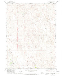
1971 Map of Old Baldy
USGS Topo · Published 1974About this map
Old Baldy rises above a landscape defined by the intricate sandhills of the Nebraska panhandle, where the high plains transition between Garden and Keith counties. This early 1970s survey captures a sparsely populated ranching region where water sources are the primary landmarks, evidenced by the numerous Well sites and the winding course of Ash Creek in the southwest. Cultural markers are few but significant for local history, including the Fairview Cem and a small Gravel Pit that suggests local infrastructure maintenance. The map illustrates the specialized land use of the era, where seasonal Spring flows and carefully managed groundwater supported the region's cattle-grazing economy amidst the characteristic blowout dunes and depressions of the sandhills.
Find a feature on this map
8 named features on this map. Tap any name to fly to it.
Don’t see what you’re looking for? This feature index may not catch every label — zoom into the map to look around manually.
Map Details
Editions of this 1971 Old Baldy Map
This is the sole edition of this map. No revisions or reprints were ever made.
Other maps of this area

1897 · Ogallala
USGS Topo · 1:125,000

1900 · Chappell
USGS Topo · 1:125,000

1900 · Ogallala
USGS Topo · 1:125,000

1949 · Rackett
USGS Topo · 1:62,500

1950 · Velma
USGS Topo · 1:62,500

1951 · Rackett
USGS Topo · 1:62,500

1954 · Scottsbluff
USGS Topo · 1:250,000

1954 · North Platte
USGS Topo · 1:250,000

1956 · North Platte
USGS Topo · 1:250,000

1957 · North Platte
USGS Topo · 1:250,000