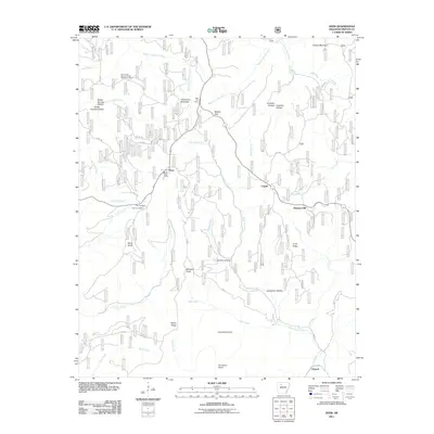
2011 Map of Deer
USGS Topo · Published 2011About this map
Deer and its neighboring highland settlements characterize this portion of Newton County, where the Ozark landscape is defined by deep hollows and prominent ridges. The presence of the Deer Post Office and the Deer Fire Tower near Henderson Mountain underscores the community's role as a local hub for the surrounding timberlands and family farms. To the north, the Alum Cove Natural Bridge Recreation Area highlights a unique geological landmark, while names like Lambdin Hollow and Slusher Hollow reflect the legacy of local families.
Find a feature on this map
46 named features on this map. Tap any name to fly to it.
Don’t see what you’re looking for? This feature index may not catch every label — zoom into the map to look around manually.
Map Details
Editions of this 2011 Deer Map
This is the sole edition of this map. No revisions or reprints were ever made.
Other maps of this area

1889 · Treat
USGS Topo · 1:62,500

1889 · Ozone
USGS Topo · 1:62,500

1932 · Treat
USGS Topo · 1:62,500

1933 · Mt Judea
USGS Topo · 1:62,500

1934 · Treat
USGS Topo · 1:62,500

1934 · Ozone
USGS Topo · 1:62,500

1936 · Ozone
USGS Topo · 1:62,500

1940 · Mt Judea
USGS Topo · 1:62,500

1956 · Russellville
USGS Topo · 1:250,000

1964 · Russellville
USGS Topo · 1:250,000