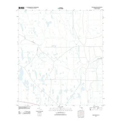
2012 Map of Deer Park NW
USGS Topo · Published 2012About this map
Wolf Cr and Pennywash Cr define the drainage patterns of this central Florida landscape, carving through terrain marked by sparse settlement and expansive ranching operations. The map provides a detailed view of the rural infrastructure in Osceola County during the early 21st century, centered near the eastern edge of the state's vast cattle country. The only significant named settlement is Orlando Ranch, situated on the eastern side of the quadrangle near the intersection of Deseret Ln.
Find a feature on this map
7 named features on this map. Tap any name to fly to it.
Don’t see what you’re looking for? This feature index may not catch every label — zoom into the map to look around manually.
Map Details
Editions of this 2012 Deer Park NW Map
This is the sole edition of this map. No revisions or reprints were ever made.
Other maps of this area

1953 · Lake Poinsett
USGS Topo · 1:24,000

1953 · Deer Park NE
USGS Topo · 1:24,000

1953 · Holopaw SE
USGS Topo · 1:24,000

1953 · Deer Park SE
USGS Topo · 1:24,000

1953 · Narcoossee SE
USGS Topo · 1:24,000

1953 · Deer Park NW
USGS Topo · 1:24,000

1953 · Lake Poinsett SW
USGS Topo · 1:24,000

1953 · Deer Park
USGS Topo · 1:24,000

1953 · Holopaw
USGS Topo · 1:24,000

1955 · Orlando
USGS Topo · 1:250,000