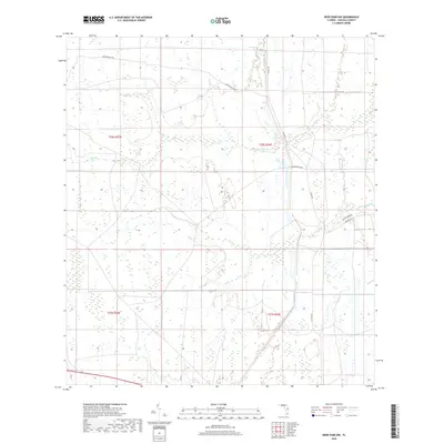
2018 Map of Deer Park NW
USGS Topo · Published 2018About this map
Wolf Cr and Pennywash Cr meander through this section of the Florida interior, defining a landscape dominated by wetlands and low-lying drainage basins. The area exhibits a sparse road network characteristic of large agricultural holdings or managed wilderness, with Gator Branch Rd serving as a primary corridor through the northern sections. This 2018 survey reveals the persistent rural character of Osceola County, where the lack of dense settlements highlights the preservation of natural hydrology. Local infrastructure is concentrated along Co Rd 419 and Co Hwy 419, while residential or ranching access is provided by smaller tracks like Buckstrand Ln and Deseret Ln. The grid-based township and range system, including t26s r33e and t27s r34e, provides the underlying structure for these expansive land parcels.
Find a feature on this map
11 named features on this map. Tap any name to fly to it.
Don’t see what you’re looking for? This feature index may not catch every label — zoom into the map to look around manually.
Map Details
Editions of this 2018 Deer Park NW Map
This is the sole edition of this map. No revisions or reprints were ever made.
Other maps of this area

1953 · Lake Poinsett
USGS Topo · 1:24,000

1953 · Deer Park NE
USGS Topo · 1:24,000

1953 · Holopaw SE
USGS Topo · 1:24,000

1953 · Deer Park SE
USGS Topo · 1:24,000

1953 · Narcoossee SE
USGS Topo · 1:24,000

1953 · Deer Park NW
USGS Topo · 1:24,000

1953 · Lake Poinsett SW
USGS Topo · 1:24,000

1953 · Deer Park
USGS Topo · 1:24,000

1953 · Holopaw
USGS Topo · 1:24,000

1955 · Orlando
USGS Topo · 1:250,000