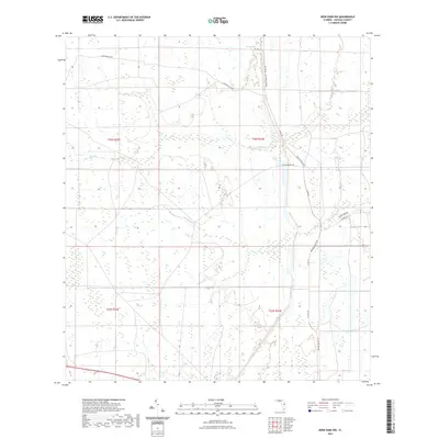
2021 Map of Deer Park NW
USGS Topo · Published 2021About this map
The lowlands of Osceola County define this portion of Florida, characterized by the winding paths of Wolf Cr and Pennywash Cr. This 2021 survey shows a landscape largely shaped by expansive agricultural and ranching operations, where the grid of the Public Land Survey System meets modern ranch infrastructure. The layout of the Deseret Ranch Trl and Deseret Ln points to the area's contemporary role within one of the largest ranching tracts in the state. Local transit is facilitated by routes such as Gator Branch Rd and Co Rd 419, which navigate through a mosaic of wetlands and open pasture. For those studying the evolution of Florida's interior, the map provides precise locations for drainage features like Buckstrand Ln and established property boundaries including t26s r34e.
Find a feature on this map
11 named features on this map. Tap any name to fly to it.
Don’t see what you’re looking for? This feature index may not catch every label — zoom into the map to look around manually.
Map Details
Editions of this 2021 Deer Park NW Map
This is the sole edition of this map. No revisions or reprints were ever made.
Other maps of this area

1953 · Lake Poinsett
USGS Topo · 1:24,000

1953 · Deer Park NE
USGS Topo · 1:24,000

1953 · Holopaw SE
USGS Topo · 1:24,000

1953 · Deer Park SE
USGS Topo · 1:24,000

1953 · Narcoossee SE
USGS Topo · 1:24,000

1953 · Deer Park NW
USGS Topo · 1:24,000

1953 · Lake Poinsett SW
USGS Topo · 1:24,000

1953 · Deer Park
USGS Topo · 1:24,000

1953 · Holopaw
USGS Topo · 1:24,000

1955 · Orlando
USGS Topo · 1:250,000