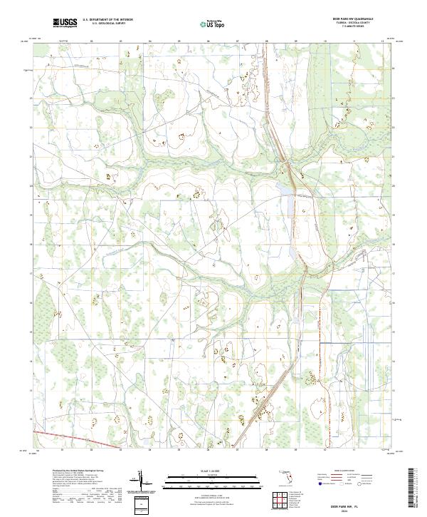
2024 Map of Deer Park NW
USGS Topo · Published 2024About this map
Wolf Creek and Pennywash Creek snake through this section of Osceola County, defining the drainage patterns of a landscape marked by ranching and rural transit. Large land tracts are partitioned by a network of established ranch trails and county infrastructure, including the long stretches of Co Rd 419 and Deseret Ranch Trl. The survey shows the modern distribution of family-named roads and rural connectors such as Gator Branch Rd and Buckstrand Ln, which provide access to the interior wetlands and pasturelands. This 2024 survey captures the persistence of the Florida ranching tradition, where water management and limited road access preserve the character of the central peninsula's interior.
Find a feature on this map
11 named features on this map. Tap any name to fly to it.
Don’t see what you’re looking for? This feature index may not catch every label — zoom into the map to look around manually.
Map Details
Editions of this 2024 Deer Park NW Map
This is the sole edition of this map. No revisions or reprints were ever made.
Other maps of this area

1953 · Lake Poinsett
USGS Topo · 1:24,000

1953 · Deer Park NE
USGS Topo · 1:24,000

1953 · Holopaw SE
USGS Topo · 1:24,000

1953 · Deer Park SE
USGS Topo · 1:24,000

1953 · Narcoossee SE
USGS Topo · 1:24,000

1953 · Deer Park NW
USGS Topo · 1:24,000

1953 · Lake Poinsett SW
USGS Topo · 1:24,000

1953 · Deer Park
USGS Topo · 1:24,000

1953 · Holopaw
USGS Topo · 1:24,000

1955 · Orlando
USGS Topo · 1:250,000