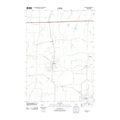
2010 Map of Deerfield
USGS Topo · Published 2010About this map
Deerfield stands as the central hub of this landscape, surrounded by the smaller settlements of Old Deerfield, London, and Kroghville. The terrain is defined by the winding course of Koshkonong Creek and its tributaries, Spring Creek and Mud Creek, which drain toward Lake Ripley in the southeast corner near Cambridge. A notable modern addition to the landscape is the Glacial Drumlin Trl, which follows the former rail corridor between London and Deerfield. Local history is anchored by sites like Hauge Cemetery and the recreational area at Oak Park, while the surrounding rural space is interconnected by a network of family-named routes such as Feenstra Rd, Jacobs Rd, and Dahl Rd. This map captures the transition of the region as former railroad hamlets adapt to their modern identities along the Dane and Jefferson County line.
Find a feature on this map
54 named features on this map. Tap any name to fly to it.
Don’t see what you’re looking for? This feature index may not catch every label — zoom into the map to look around manually.
Map Details
Editions of this 2010 Deerfield Map
This is the sole edition of this map. No revisions or reprints were ever made.
Other maps of this area

1890 · Sun Prairie
USGS Topo · 1:62,500

1890 · Stoughton
USGS Topo · 1:62,500

1891 · Waterloo
USGS Topo · 1:62,500

1891 · Koshkonong
USGS Topo · 1:62,500

1894 · Waterloo
USGS Topo · 1:62,500

1894 · Koshkonong
USGS Topo · 1:62,500

1896 · Sun Prairie
USGS Topo · 1:62,500

1905 · Sun Prairie
USGS Topo · 1:62,500

1906 · Koshkonong
USGS Topo · 1:62,500

1907 · Sun Prairie
USGS Topo · 1:62,500