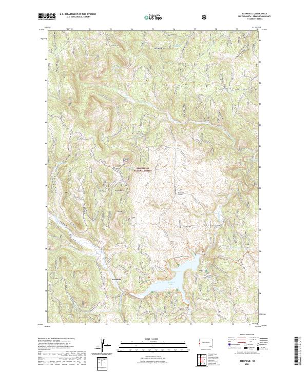
2021 Map of Deerfield
USGS Topo · Published 2021About this map
Farmington serves as the central hub in this 1948 topographic map, where the Maine Central RR winds along the banks of the Sandy River. The landscape is defined by its dramatic relief, with prominent peaks like Mt Blue, Starbird Hill, Porter Hill, and Titcomb Hill overlooking the river valleys. Smaller communities such as West Farmington and Farmington Falls appear as established settlements connected by a network of rural roads. The map captures the agricultural and industrial character of the mid-20th-century Maine interior, documenting vital local landmarks like the Center Hill Sch and Fairview Cem. Natural drainage is evident through waterways like Temple Stream, which feed into the larger river system.
Find a feature on this map
120 named features on this map. Tap any name to fly to it.
Don’t see what you’re looking for? This feature index may not catch every label — zoom into the map to look around manually.
Map Details
Editions of this 2021 Deerfield Map
This is the sole edition of this map. No revisions or reprints were ever made.
Other maps of this area

1894 · Deadwood
USGS Topo · 1:125,000

1896 · Harney Peak
USGS Topo · 1:125,000

1901 · Harney Peak
USGS Topo · 1:125,000

1901 · Deadwood
USGS Topo · 1:125,000

1916 · Deadwood
USGS Topo · 1:125,000

1953 · Rapid City
USGS Topo · 1:250,000

1955 · Hot Springs
USGS Topo · 1:250,000
1956 · Custer
USGS Topo · 1:62,500
1956 · Crooks Tower
USGS Topo · 1:24,000
1956 · Crows Nest Peak
USGS Topo · 1:24,000