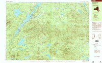
1997 Map of Deerland
USGS Topo · Published 1999About this map
The village of Long Lake and the settlement of Deerland serve as the primary human outposts in this expansive stretch of the Adirondack Park. Recorded in the late 1990s, the map reveals a landscape defined by the intersection of water and mountainous terrain, where the Raquette River feeds into the southern reaches of the lake. Near the water's edge, community landmarks such as a Post Office, Pine Island Park, and a Boat Ramp indicate a seasonal and recreational hub centered around the northern Adirondack waters. Away from the lake, the terrain rises sharply toward summits like Blue Mountain and Windfall Mountain. The presence of a Snowmobile Trail and numerous named water bodies like Lake Eaton and Salmon Pond underscores the area's identity as a remote wilderness corridor managed across the Hamilton and Essex county line.
Find a feature on this map
63 named features on this map. Tap any name to fly to it.
Don’t see what you’re looking for? This feature index may not catch every label — zoom into the map to look around manually.
Map Details
Editions of this 1997 Deerland Map
This is the sole edition of this map. No revisions or reprints were ever made.
Other maps of this area

1898 · Newcomb
USGS Topo · 1:62,500

1901 · Newcomb
USGS Topo · 1:62,500

1903 · Raquette Lake
USGS Topo · 1:62,500

1903 · Blue Mountain
USGS Topo · 1:62,500

1904 · Santanoni
USGS Topo · 1:62,500

1904 · Long Lake
USGS Topo · 1:62,500

1907 · Tupper Lake
USGS Topo · 1:62,500

1948 · Ogdensburg
USGS Topo · 1:250,000

1950 · Utica
USGS Topo · 1:250,000

1951 · Ogdensburg
USGS Topo · 1:250,000