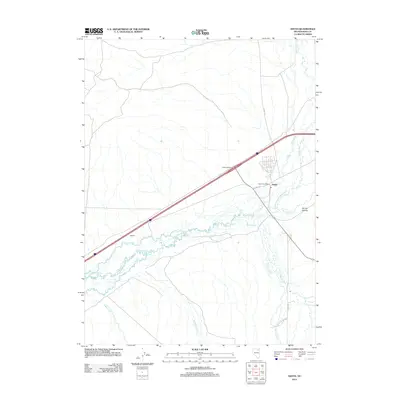
2012 Map of Deeth
USGS Topo · Published 2012About this map
The settlement of Deeth lies at a critical hydrological junction in northeastern Nevada where the Humboldt River receives the waters of the Marys River. This 2012 survey shows the community centered around the Deeth Post Office, served by local routes like Starr Ln and Co Hwy-753. The landscape is defined by a dense network of watercourses, including Starr Creek, Stephens Creek, and Boulder Creek, which converge in this low-lying basin. To the west, the locality of Natchez sits near the riverbanks, while the modern infrastructure of the Deeth Interchange facilitates travel through the high desert. This area has long served as a vital corridor for both natural drainage and human transit, with the geography of Spring Hollow and various creek beds dictating the placement of ranching roads and early settlements.
Find a feature on this map
17 named features on this map. Tap any name to fly to it.
Don’t see what you’re looking for? This feature index may not catch every label — zoom into the map to look around manually.
Map Details
Editions of this 2012 Deeth Map
This is the sole edition of this map. No revisions or reprints were ever made.
Other maps of this area

1935 · Halleck
USGS Topo · 1:125,000

1955 · Wells
USGS Topo · 1:250,000

1955 · Elko
USGS Topo · 1:250,000

1958 · Wells
USGS Topo · 1:250,000

1958 · Elko
USGS Topo · 1:250,000

1961 · Wells
USGS Topo · 1:250,000

1962 · Elko
USGS Topo · 1:250,000

1965 · Elko
USGS Topo · 1:250,000

1967 · Twin Buttes
USGS Topo · 1:24,000

1967 · Peko Peak
USGS Topo · 1:24,000