
1967 Map of Peko Peak
USGS Topo · Published 1971About this map
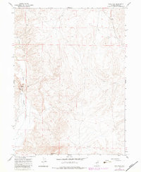
Peko Peak stands as the primary elevation in this corner of Elko County, overseeing a landscape defined by the drainage of the North Fork Humboldt River. During the mid-1960s, this area remained largely undeveloped, characterized by the winding riverbed and its major tributaries, including Pole Creek, Allen Creek, and Winter Creek. A notable narrow passage in the terrain is marked at Devils Gate, located just upstream from a Gaging Sta used for monitoring river flow. The map provides a clear look at the township and range divisions of the era, illustrating the relationship between the natural hydrology and the early surveying of the Nevada backcountry before significant modern alteration.
Find a feature on this map
9 named features on this map. Tap any name to fly to it.
Don’t see what you’re looking for? This feature index may not catch every label — zoom into the map to look around manually.
Map Details
Editions of this 1967 Peko Peak Map
2 editions found
Other maps of this area

1955 · Wells
USGS Topo · 1:250,000

1958 · Wells
USGS Topo · 1:250,000

1961 · Wells
USGS Topo · 1:250,000

1967 · Hanks Creek SW
USGS Topo · 1:24,000

1967 · Hot Springs Creek
USGS Topo · 1:24,000

1967 · Twin Buttes
USGS Topo · 1:24,000
1967 · Deeth
USGS Topo · 1:24,000
1967 · Morgan Hill
USGS Topo · 1:24,000

1971 · Double Mtn SE
USGS Topo · 1:24,000
1971 · Coal Mine Canyon SE
USGS Topo · 1:24,000