1967 Map of Morgan Hill
USGS Topo · Published 1972About this map
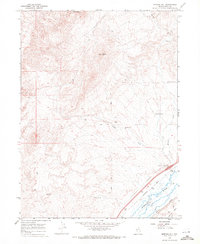
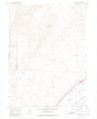
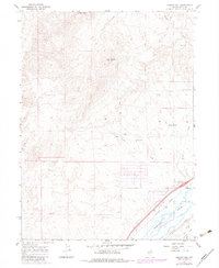
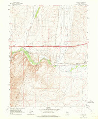
The Humboldt River corridor dominates the southeastern corner of this high-desert landscape, where the legacy of early transcontinental transportation is clearly visible. The parallel lines of the Southern Pacific and Western Pacific railroads follow the river's path, tracing the vital transit route through the Great Basin that sustained Western expansion. Nearby, the River Ranch and its associated River Ranch Interchange mark a transition point between the valley floor and the ascending terrain of the high country.
Find a feature on this map
18 named features on this map. Tap any name to fly to it.
Don’t see what you’re looking for? This feature index may not catch every label — zoom into the map to look around manually.
Map Details
Editions of this 1967 Morgan Hill Map
3 editions found
Other maps of this area
1935 · Halleck
USGS Topo · 1:125,000

1955 · Wells
USGS Topo · 1:250,000

1955 · Elko
USGS Topo · 1:250,000

1958 · Wells
USGS Topo · 1:250,000

1958 · Elko
USGS Topo · 1:250,000

1961 · Wells
USGS Topo · 1:250,000

1962 · Elko
USGS Topo · 1:250,000
1962 · Ryndon
USGS Topo · 1:24,000

1965 · Elko
USGS Topo · 1:250,000
1967 · Twin Buttes
USGS Topo · 1:24,000