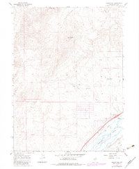
1967 Map of Morgan Hill
USGS Topo · Published 1983About this map
The Humboldt River corridor dominates this high-desert landscape of Elko County, serving as the primary artery for both transportation and water. In the late 1960s, the valley floor shows a complex infrastructure network where the Southern Pacific and Western Pacific railroads parallel the river, supporting the ranching economy at River Ranch. The introduction of the River Ranch Interchange marks the modernization of regional travel during this period, connecting the river valley to the surrounding uplands.
Find a feature on this map
18 named features on this map. Tap any name to fly to it.
Don’t see what you’re looking for? This feature index may not catch every label — zoom into the map to look around manually.
Map Details
Editions of this 1967 Morgan Hill Map
3 editions found
Other maps of this area

1935 · Halleck
USGS Topo · 1:125,000

1955 · Wells
USGS Topo · 1:250,000

1955 · Elko
USGS Topo · 1:250,000

1958 · Wells
USGS Topo · 1:250,000

1958 · Elko
USGS Topo · 1:250,000

1961 · Wells
USGS Topo · 1:250,000

1962 · Elko
USGS Topo · 1:250,000

1962 · Ryndon
USGS Topo · 1:24,000

1965 · Elko
USGS Topo · 1:250,000

1967 · Twin Buttes
USGS Topo · 1:24,000