
1967 Map of Hot Springs Creek
USGS Topo · Published 1971About this map
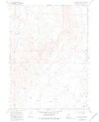
Mala Vista Ranch anchors the northeastern portion of this High Desert landscape, where the geography is defined by a complex network of seasonal drainages and thermal activity. The eponymous Hot Springs Creek flows through the southern half of the quadrangle, eventually meeting the Marys River in the southeast corner. This confluence is monitored by a Gaging Sta, indicating the importance of water management in this arid cattle-ranching region. Evidence of mid-century infrastructure is visible near the ranch, including a designated Landing Area and a Water Tank, likely serving both aerial and terrestrial transit across the high plateaus. A rugged Jeep Trail provides the primary passage through the central hills, connecting various unnamed Springs and Spring points that sustain local livestock. In the north, Hanks Creek cuts through the high elevation, marking a terrain where natural water sources dictate the placement of human activity.
Find a feature on this map
11 named features on this map. Tap any name to fly to it.
Don’t see what you’re looking for? This feature index may not catch every label — zoom into the map to look around manually.
Map Details
Editions of this 1967 Hot Springs Creek Map
2 editions found
Other maps of this area

1955 · Wells
USGS Topo · 1:250,000

1958 · Wells
USGS Topo · 1:250,000

1961 · Wells
USGS Topo · 1:250,000

1967 · Hanks Creek SW
USGS Topo · 1:24,000

1967 · Black Butte SW
USGS Topo · 1:24,000

1967 · Twin Buttes
USGS Topo · 1:24,000

1967 · Stag Mountain
USGS Topo · 1:24,000

1967 · Buena Vista Ranch
USGS Topo · 1:24,000

1967 · Peko Peak
USGS Topo · 1:24,000

1967 · Hanks Creek NE
USGS Topo · 1:24,000