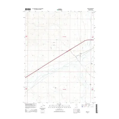
2015 Map of Deeth
USGS Topo · Published 2015About this map
The settlement of Deeth occupies a central role in this high-desert Nevada landscape, situated where the Humboldt River and Marys River converge. This 2015 survey details a ranching and transport corridor defined by the perennial waters of Starr Cr, Stephens Cr, and Boulder Cr which flow from the south. The terrain is marked by the Peko Hills to the northeast and the open expanse of Dennis Flats and Spring Hollow to the south and east. A grid of local roads north of the interstate, including Aires Ave and Virgo Ave, suggests planned development or land division near the older community. The confluence of these major river channels has long dictated the placement of travel routes like Deeth Oneil Rd and NV-230, making this map an essential document for tracing the modern rural infrastructure of Elko County.
Find a feature on this map
30 named features on this map. Tap any name to fly to it.
Don’t see what you’re looking for? This feature index may not catch every label — zoom into the map to look around manually.
Map Details
Editions of this 2015 Deeth Map
This is the sole edition of this map. No revisions or reprints were ever made.
Other maps of this area

1935 · Halleck
USGS Topo · 1:125,000

1955 · Wells
USGS Topo · 1:250,000

1955 · Elko
USGS Topo · 1:250,000

1958 · Wells
USGS Topo · 1:250,000

1958 · Elko
USGS Topo · 1:250,000

1961 · Wells
USGS Topo · 1:250,000

1962 · Elko
USGS Topo · 1:250,000

1965 · Elko
USGS Topo · 1:250,000

1967 · Twin Buttes
USGS Topo · 1:24,000

1967 · Peko Peak
USGS Topo · 1:24,000