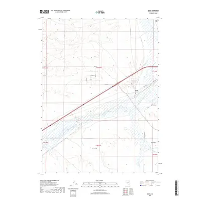
2018 Map of Deeth
USGS Topo · Published 2018About this map
Humboldt River and its major tributaries define the geography of this northeastern Nevada corridor, where the historic settlement of Deeth sits at a critical junction of water and transit. This 2018 survey illustrates the complex hydrology of the region, specifically where the Marys River and the E Channel Marys River merge into the Humboldt. To the south, the landscape transitions into the agricultural and ranching lands of Starr Valley, framed by the drainage of Starr Cr and Ackler Cr.
Find a feature on this map
31 named features on this map. Tap any name to fly to it.
Don’t see what you’re looking for? This feature index may not catch every label — zoom into the map to look around manually.
Map Details
Editions of this 2018 Deeth Map
This is the sole edition of this map. No revisions or reprints were ever made.
Other maps of this area

1935 · Halleck
USGS Topo · 1:125,000

1955 · Wells
USGS Topo · 1:250,000

1955 · Elko
USGS Topo · 1:250,000

1958 · Wells
USGS Topo · 1:250,000

1958 · Elko
USGS Topo · 1:250,000

1961 · Wells
USGS Topo · 1:250,000

1962 · Elko
USGS Topo · 1:250,000

1965 · Elko
USGS Topo · 1:250,000

1967 · Twin Buttes
USGS Topo · 1:24,000

1967 · Peko Peak
USGS Topo · 1:24,000