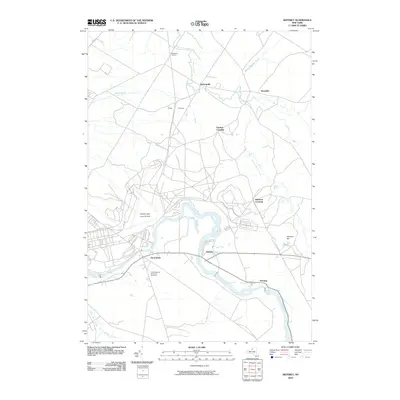
2010 Map of Deferiet
USGS Topo · Published 2010About this map
The Black River winds through the heart of Jefferson County, New York, defining a corridor of riverside settlements that include Deferiet, Great Bend, and Herrings. This modern topographic survey highlights a landscape dominated by the sprawling infrastructure of Wheeler Sack Army Air Field, which occupies a significant portion of the western territory. For local historians, the inclusion of the F W Woolworth Memorial Cemetery provides a specific point of genealogical interest south of the river. To the north, the terrain transitions into more rural character near Pine Plains, where the road network connects smaller hubs such as Sterlingville and Strickland Corners. The drainage patterns are clearly defined by numerous tributaries like Trout Brook, Beaver Meadow Creek, and the West Branch Black Creek, showing how the hydrology of the region continues to shape land use and local boundaries around these established communities.
Find a feature on this map
20 named features on this map. Tap any name to fly to it.
Don’t see what you’re looking for? This feature index may not catch every label — zoom into the map to look around manually.
Map Details
Editions of this 2010 Deferiet Map
This is the sole edition of this map. No revisions or reprints were ever made.
Other maps of this area

1895 · Watertown
USGS Topo · 1:62,500

1898 · Watertown
USGS Topo · 1:62,500

1902 · Carthage
USGS Topo · 1:62,500

1903 · Theresa
USGS Topo · 1:62,500

1904 · Carthage
USGS Topo · 1:62,500

1908 · Watertown
USGS Topo · 1:62,500

1909 · Watertown
USGS Topo · 1:62,500

1911 · Antwerp
USGS Topo · 1:62,500

1942 · Copenhagen
USGS Topo · 1:24,000

1943 · Copenhagen
USGS Topo · 1:31,680