2023 Map of Deferiet
USGS Topo · Published 2023About this map
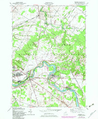
Fort Drum dominates the northern and central landscape of this Jefferson County quadrangle, encompassing the Wheeler-Sack Army Airfield and numerous tactical routes like S Tank Trl. This military installation is bordered by several distinct river communities that grew alongside the Black River, which cuts a dramatic path through the southern half of the map. The spatial relationship between the military reservation and civilian settlements such as Deferiet, Herrings, and Great Bend is clearly defined, showing how the local road network, including Co Rd 36 and Co Rd 37, serves both the base and the residential enclaves.
Find a feature on this map
84 named features on this map. Tap any name to fly to it.
Don’t see what you’re looking for? This feature index may not catch every label — zoom into the map to look around manually.
Map Details
Editions of this 2023 Deferiet Map
This is the sole edition of this map. No revisions or reprints were ever made.
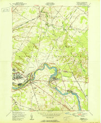
Historical Maps of Sterlingville Through Time
3 maps found