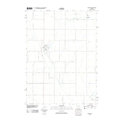
2010 Map of Defiance
USGS Topo · Published 2010About this map
Defiance serves as the central hub of this Shelby County landscape, where the Defiance Post Office and Saint Pauls Cemetery anchor the local community. The terrain is defined by the winding course of the West Fork West Nishnabotna River, which is joined by tributaries like Willow Creek and Kidds Creek. This hydrography creates a distinct pattern of drainage across the agricultural grid, particularly visible near the small settlement of Astor to the northeast.
Find a feature on this map
32 named features on this map. Tap any name to fly to it.
Don’t see what you’re looking for? This feature index may not catch every label — zoom into the map to look around manually.
Map Details
Editions of this 2010 Defiance Map
This is the sole edition of this map. No revisions or reprints were ever made.
Other maps of this area

1954 · Omaha
USGS Topo · 1:250,000

1957 · Omaha
USGS Topo · 1:250,000

1958 · Omaha
USGS Topo · 1:250,000

1971 · Earling
USGS Topo · 1:24,000

1971 · Earling NE
USGS Topo · 1:24,000
1971 · Dow City
USGS Topo · 1:24,000

1971 · Defiance
USGS Topo · 1:24,000

1978 · Panama
USGS Topo · 1:24,000

1978 · Manilla
USGS Topo · 1:24,000

1978 · Irwin
USGS Topo · 1:24,000