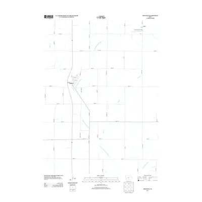
2013 Map of Defiance
USGS Topo · Published 2013About this map
The town of Defiance sits near the western edge of this Shelby County landscape, organized around a grid that includes Main Ave and Railway St, reflecting the transportation patterns of the region. The area is defined by the winding course of the W Fork W Nishnabotna River, which meanders southeast toward its confluence with the W Nishnabotna River. To the northeast, the smaller settlement of Astor is situated near the Nishnabotna River Bridge, marking a key crossing point in the rural road network. The terrain is deeply etched by a network of drainage systems, including Kidds Cr and Willow Cr, which influence the placement of the county roads and section lines that divide the agricultural fields. This 2013 survey provides a clear view of the intersection between these natural watercourses and the established township infrastructure.
Find a feature on this map
42 named features on this map. Tap any name to fly to it.
Don’t see what you’re looking for? This feature index may not catch every label — zoom into the map to look around manually.
Map Details
Editions of this 2013 Defiance Map
This is the sole edition of this map. No revisions or reprints were ever made.
Other maps of this area

1954 · Omaha
USGS Topo · 1:250,000

1957 · Omaha
USGS Topo · 1:250,000

1958 · Omaha
USGS Topo · 1:250,000

1971 · Earling
USGS Topo · 1:24,000

1971 · Earling NE
USGS Topo · 1:24,000
1971 · Dow City
USGS Topo · 1:24,000

1971 · Defiance
USGS Topo · 1:24,000

1978 · Panama
USGS Topo · 1:24,000

1978 · Manilla
USGS Topo · 1:24,000

1978 · Irwin
USGS Topo · 1:24,000