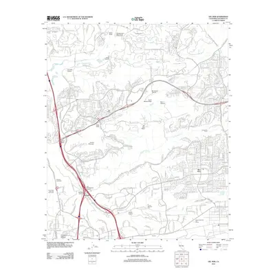
2012 Map of Del Mar
USGS Topo · Published 2012About this map
Sorrento and the surrounding coastal mesas show a landscape defined by sharp topographical transitions and rapid suburban growth at the start of the 2010s. The northern portion of the map is dominated by the San Dieguito River valley and the upscale developments of Fairbanks Ranch and Osuna Valley. Moving south, the terrain becomes a series of high ridges and deep incisions like McGonigle Canyon and Deer Canyon, which separate established communities such as Mira Mesa and Carmel Valley. The southern edge is anchored by large institutional footprints, including the University of California - San Diego and the industrial corridors of Miramar. Key recreational and memorial spaces like the Torrey Pines Municipal Golf Course and El Camino Memorial Park provide significant green breaks in the dense residential fabric.
Find a feature on this map
64 named features on this map. Tap any name to fly to it.
Don’t see what you’re looking for? This feature index may not catch every label — zoom into the map to look around manually.
Map Details
Editions of this 2012 Del Mar Map
This is the sole edition of this map. No revisions or reprints were ever made.
Other maps of this area

1893 · Oceanside
USGS Topo · 1:62,500

1893 · Escondido
USGS Topo · 1:62,500

1898 · Oceanside
USGS Topo · 1:62,500

1901 · Escondido
USGS Topo · 1:62,500

1901 · Oceanside
USGS Topo · 1:62,500

1901 · San Luis Rey
USGS Topo · 1:125,000

1903 · La Jolla
USGS Topo · 1:62,500

1904 · Southern California Sheet No. 2
USGS Topo · 1:250,000

1930 · La Jolla
USGS Topo · 1:62,500

1942 · Poway Valley
USGS Topo · 1:31,680
Featured Places
- San Diego, CA
- Solana Beach, CA
- Fairbanks Ranch, CA
- Sorrento Valley, San Diego
- Rancho Peñasquitos, San Diego