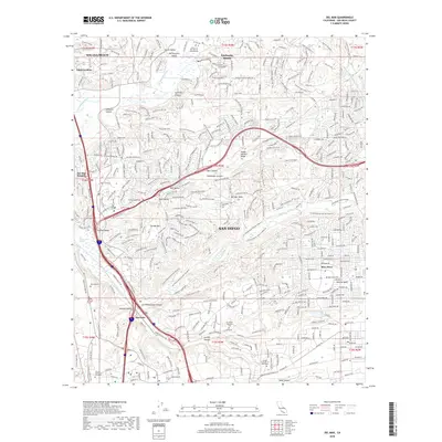
2018 Map of Del Mar
USGS Topo · Published 2018About this map
San Diego's northern coastal interface and inland canyons are meticulously charted here, revealing a landscape defined by sharp topographical transitions and rapid suburban growth. The map centers on the massive Los Peñasquitos Canyon Preserve, which cuts a swath of protected open space through the surrounding developed mesas and valleys. To the south, the industrial and commercial hubs of Sorrento and Mira Mesa show dense urbanization, including landmarks like the Design Institute of San Diego and the expansive El Camino Memorial Park.
Find a feature on this map
47 named features on this map. Tap any name to fly to it.
Don’t see what you’re looking for? This feature index may not catch every label — zoom into the map to look around manually.
Map Details
Editions of this 2018 Del Mar Map
This is the sole edition of this map. No revisions or reprints were ever made.
Other maps of this area

1893 · Oceanside
USGS Topo · 1:62,500

1893 · Escondido
USGS Topo · 1:62,500

1898 · Oceanside
USGS Topo · 1:62,500

1901 · Escondido
USGS Topo · 1:62,500

1901 · Oceanside
USGS Topo · 1:62,500

1901 · San Luis Rey
USGS Topo · 1:125,000

1903 · La Jolla
USGS Topo · 1:62,500

1904 · Southern California Sheet No. 2
USGS Topo · 1:250,000

1930 · La Jolla
USGS Topo · 1:62,500

1942 · Poway Valley
USGS Topo · 1:31,680
Featured Places
- San Diego, CA
- Solana Beach, CA
- Fairbanks Ranch, CA
- Sorrento Valley, San Diego
- Rancho Peñasquitos, San Diego