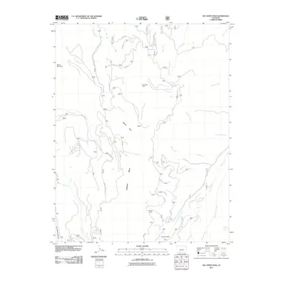
2011 Map of Del Norte Peak
USGS Topo · Published 2011About this map
Del Norte Peak and Beaver Mountain anchor this high-elevation landscape in Rio Grande County, which is defined by a dense network of high-country drainage systems and expansive alpine meadows. The terrain falls away from these summits toward Willow Park and Ruston Park, offering a clear view of the complex hydrology that feeds the Rio Grande basin. The southern portion of the sheet highlights the seasonal use of the land, evidenced by Double Cabins Park and the winding Beaver Creek Rd. The convergence of several forks, including the West Fork Pinos Creek and East Fork Pinos Creek, illustrates the essential role of these headwaters. Throughout the quadrangle, old routes like Toll Gate Creek suggest the historical movement of people and livestock through these high-altitude passes and along the Hogback Mesa.
Find a feature on this map
25 named features on this map. Tap any name to fly to it.
Don’t see what you’re looking for? This feature index may not catch every label — zoom into the map to look around manually.
Map Details
Editions of this 2011 Del Norte Peak Map
This is the sole edition of this map. No revisions or reprints were ever made.
Other maps of this area

1913 · Summitville
USGS Topo · 1:125,000

1914 · Creede
USGS Topo · 1:125,000

1915 · Summitville
USGS Topo · 1:125,000

1915 · Del Norte
USGS Topo · 1:125,000

1916 · Creede
USGS Topo · 1:125,000

1917 · Del Norte
USGS Topo · 1:125,000

1922 · Conejos
USGS Topo · 1:125,000

1945 · Durango
USGS Topo · 1:250,000

1953 · Durango
USGS Topo · 1:250,000

1954 · Durango
USGS Topo · 1:250,000