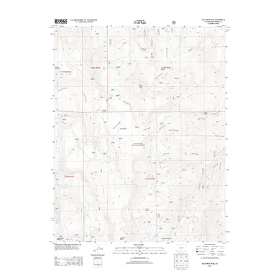
2013 Map of Del Norte Peak
USGS Topo · Published 2013About this map
Del Norte Peak and Beaver Mountain anchor this high-altitude landscape within the Rio Grande National Forest, where a complex network of seasonal drainages and alpine parks defines the geography. High-country basins such as Willow Park, Ruston Park, and Double Cabins Park suggest the traditional use of these uplands for summer grazing and recreation. The map meticulously documents the drainage systems of the San Juan Mountains, including the headwaters of Willow Creek, Wolf Creek, and Shaw Creek.
Find a feature on this map
36 named features on this map. Tap any name to fly to it.
Don’t see what you’re looking for? This feature index may not catch every label — zoom into the map to look around manually.
Map Details
Editions of this 2013 Del Norte Peak Map
This is the sole edition of this map. No revisions or reprints were ever made.
Other maps of this area

1913 · Summitville
USGS Topo · 1:125,000

1914 · Creede
USGS Topo · 1:125,000

1915 · Summitville
USGS Topo · 1:125,000

1915 · Del Norte
USGS Topo · 1:125,000

1916 · Creede
USGS Topo · 1:125,000

1917 · Del Norte
USGS Topo · 1:125,000

1922 · Conejos
USGS Topo · 1:125,000

1945 · Durango
USGS Topo · 1:250,000

1953 · Durango
USGS Topo · 1:250,000

1954 · Durango
USGS Topo · 1:250,000