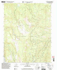
2001 Map of Del Norte Peak
USGS Topo · Published 2005About this map
Del Norte Peak towers over this section of the Rio Grande National Forest, a landscape defined by sharp drainage basins and high-elevation parklands. The 2001 revision illustrates a complex network of forest management and recreation, where the Cross Creek Trail and Shady Creek Trail navigate between prominent landforms like Hogback Mesa and Beaver Mountain.
Find a feature on this map
32 named features on this map. Tap any name to fly to it.
Don’t see what you’re looking for? This feature index may not catch every label — zoom into the map to look around manually.
Map Details
Editions of this 2001 Del Norte Peak Map
This is the sole edition of this map. No revisions or reprints were ever made.
Other maps of this area

1913 · Summitville
USGS Topo · 1:125,000

1914 · Creede
USGS Topo · 1:125,000

1915 · Summitville
USGS Topo · 1:125,000

1915 · Del Norte
USGS Topo · 1:125,000

1916 · Creede
USGS Topo · 1:125,000

1917 · Del Norte
USGS Topo · 1:125,000

1922 · Conejos
USGS Topo · 1:125,000

1945 · Durango
USGS Topo · 1:250,000

1953 · Durango
USGS Topo · 1:250,000

1954 · Durango
USGS Topo · 1:250,000