2022 Map of Del Norte
USGS Topo · Published 2022About this map
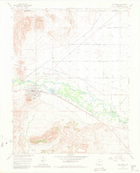
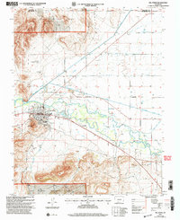
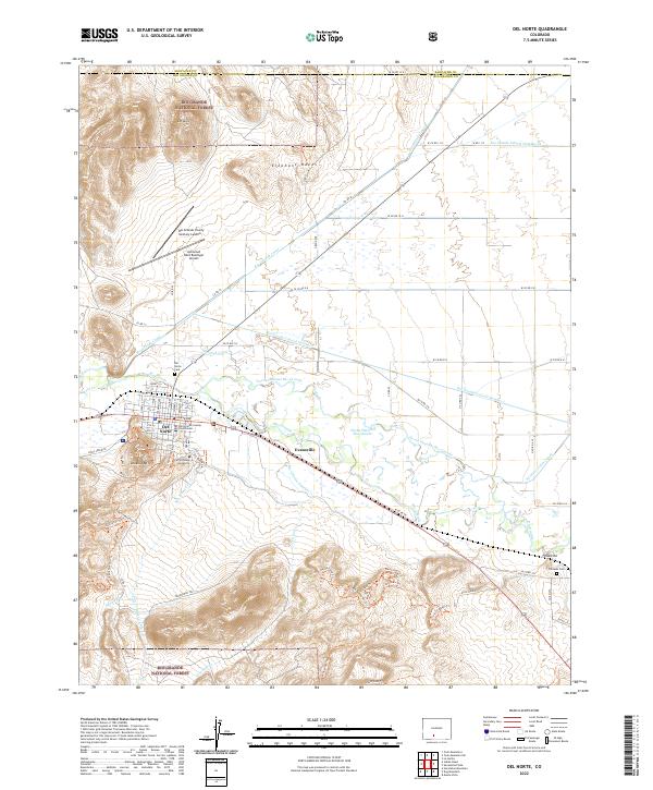
The Rio Grande flows through this San Luis Valley landscape, supporting a complex network of irrigation infrastructure including the Rio Grande Canal, the Midland Canal, and the Farmers Union Canal. These waterways define the agricultural character of the region surrounding the town of Del Norte, where the Rio Grande County Courthouse serves as a central landmark. The town's grid is clearly visible, flanked by the Astronaut Kent Rominger Airport to the north and the slopes of Lookout Mtn to the south.
Find a feature on this map
92 named features on this map. Tap any name to fly to it.
Don’t see what you’re looking for? This feature index may not catch every label — zoom into the map to look around manually.
Map Details
Editions of this 2022 Del Norte Map
This is the sole edition of this map. No revisions or reprints were ever made.
Historical Maps of Evansville Through Time
6 maps found