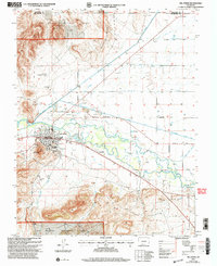
2001 Map of Del Norte
USGS Topo · Published 2005About this map
The Rio Grande defines the character of this 2001 Colorado landscape, cutting through the center of the sheet and feeding an intricate network of irrigation systems. Settlements like Del Norte and Evansville sit along the riverbanks, supported by a series of engineered waterways including the Farmers Union Canal, Rio Grande Canal, and Midland Canal. To the north and south, the terrain rises sharply into the Rio Grande National Forest, marked by landmarks such as the Elephant Rocks and Lookout Mountain. Local history and genealogy interest is concentrated around the Del Norte Cem and the small communities of Peñascito and Valdeses in the southeast. The map reveals the vital connection between the river and the surrounding high-desert agriculture, where named laterals and gravel pits show a landscape shaped by water management and resource extraction.
Find a feature on this map
42 named features on this map. Tap any name to fly to it.
Don’t see what you’re looking for? This feature index may not catch every label — zoom into the map to look around manually.
Map Details
Editions of this 2001 Del Norte Map
This is the sole edition of this map. No revisions or reprints were ever made.
Other maps of this area

1915 · Del Norte
USGS Topo · 1:125,000

1917 · Del Norte
USGS Topo · 1:125,000

1945 · Durango
USGS Topo · 1:250,000

1953 · Durango
USGS Topo · 1:250,000

1954 · Durango
USGS Topo · 1:250,000

1961 · Durango
USGS Topo · 1:250,000

1963 · Durango
USGS Topo · 1:250,000

1964 · Sevenmile Plaza
USGS Topo · 1:24,000

1964 · Monte Vista
USGS Topo · 1:24,000

1966 · Durango
USGS Topo · 1:250,000