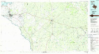
1986 Map of Del Rio
USGS Topo · Published 1986About this map
Del Rio serves as the primary urban hub on this West Texas borderlands survey, situated where the Rio Grande meets the freshwater flows of San Felipe Creek. The landscape transitions from the developed grid of the city and the expansive Laughlin AFB into the ranchlands of the Edwards Plateau. Further east, Brackettville stands near the headwaters of Las Moras Creek, while smaller settlements like Spofford, Cline, and Dabney trace the path of the Southern Pacific and Missouri Pacific railroads.
Find a feature on this map
100 named features on this map. Tap any name to fly to it.
Don’t see what you’re looking for? This feature index may not catch every label — zoom into the map to look around manually.
Map Details
Editions of this 1986 Del Rio Map
2 editions found
Other maps of this area

1893 · Nueces
USGS Topo · 1:125,000

1896 · Nueces
USGS Topo · 1:125,000

1896 · Brackett
USGS Topo · 1:125,000

1897 · Brackett
USGS Topo · 1:125,000

1898 · Uvalde
USGS Topo · 1:125,000

1899 · Uvalde
USGS Topo · 1:125,000

1938 · Turkey Mountain
USGS Topo · 1:48,000

1939 · La Pryor
USGS Topo · 1:62,500

1940 · Paloma
USGS Topo · 1:62,500

1940 · Quemado
USGS Topo · 1:62,500