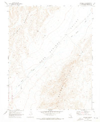
1969 Map of Delamar 3 SE
USGS Topo · Published 1973About this map
Kane Springs Valley dominates this high-desert landscape in Lincoln County, as documented by the Geological Survey during field checks in 1969. The topography is defined by the broad corridor of Kane Springs Wash, which separates the eastern slopes of the Delamar Mountains from the Meadow Valley Mts to the southeast. Remote water sources, critical for survival and cattle in this arid environment, are specifically located at Willow Spring and near several Water Tanks along the valley floor. The map illustrates the natural drainage patterns and elevation shifts of this uninhabited basin before more modern developments altered the land, making it a valuable record of the area's mid-century physical state.
Find a feature on this map
6 named features on this map. Tap any name to fly to it.
Don’t see what you’re looking for? This feature index may not catch every label — zoom into the map to look around manually.
Map Details
Editions of this 1969 Delamar 3 SE Map
2 editions found
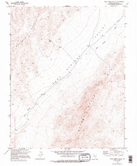
Other maps of this area

1885 · Pioche
USGS Topo · 1:250,000

1886 · Saint Thomas
USGS Topo · 1:250,000

1886 · Pioche
USGS Topo · 1:250,000

1893 · Saint Thomas
USGS Topo · 1:250,000

1954 · Caliente
USGS Topo · 1:250,000

1954 · Las Vegas
USGS Topo · 1:250,000

1957 · Las Vegas
USGS Topo · 1:250,000

1959 · Caliente
USGS Topo · 1:250,000

1959 · Las Vegas
USGS Topo · 1:250,000

1962 · Las Vegas
USGS Topo · 1:250,000