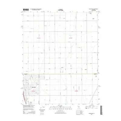
2015 Map of Delano East
USGS Topo · Published 2015About this map
The agricultural landscape of the San Joaquin Valley is defined by a rigorous grid of section lines and irrigation infrastructure in this mid-2010s survey. The city of Delano occupies the southwestern quadrant, showing a dense residential layout extending from 9th Ave up toward the industrial and transport corridor. Critical water management is evident through the path of the Friant-Kern Canal and the natural course of the White River, which together sustain the productive Central Valley floor. Small established points like Jovista and Trocha sit along the Tulare Co Kern Co boundary line, representing the historic small-scale settlements that dot the region's massive orchard and field operations. To the southeast, the Delano Municipal Airport and the undulating terrain of Rag Gulch mark the transition from flat valley bottom to the rising eastern foothills.
Find a feature on this map
77 named features on this map. Tap any name to fly to it.
Don’t see what you’re looking for? This feature index may not catch every label — zoom into the map to look around manually.
Map Details
Editions of this 2015 Delano East Map
This is the sole edition of this map. No revisions or reprints were ever made.
Other maps of this area

1927 · McFarland
USGS Topo · 1:31,680

1929 · Delano
USGS Topo · 1:31,680

1929 · Sausalito School
USGS Topo · 1:31,680

1929 · Richgrove
USGS Topo · 1:31,680

1929 · Pixley
USGS Topo · 1:31,680

1929 · Stone
USGS Topo · 1:31,680

1929 · Ducor
USGS Topo · 1:31,680

1930 · McFarland
USGS Topo · 1:31,680

1930 · Pond
USGS Topo · 1:31,680

1931 · Deepwell Ranch
USGS Topo · 1:31,680
Featured Places
- Delano, CA
- Cypress Gardens Mobile Home Community, Delano
- Delano Mobile Home Park, Delano
- Kern County, CA
- Tulare County, CA