
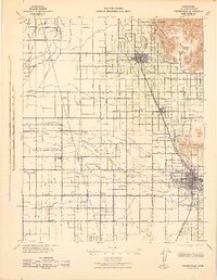
1929 Map of Sausalito School
USGS Topo · Published 1929About this map
Deer Creek carves a winding path through this Tulare County landscape, reflecting the agricultural and infrastructure development of the San Joaquin Valley in the late 1920s. The survey reveals a region defined by its rural education system, notably anchoring the area with Sausalito Sch and Zion Sch. The topography is relatively flat, marked primarily by a series of bench marks such as B M 325 and B M 389, which served as critical reference points for the intensive irrigation and land management required for local farming. Modern industrial expansion is evident in the prominent Southern California Edison Co Transmission Line that cuts across the eastern sections, signaling the arrival of large-scale electrical infrastructure to support the growing power needs of Central California's interior.
Find a feature on this map
8 named features on this map. Tap any name to fly to it.
Don’t see what you’re looking for? This feature index may not catch every label — zoom into the map to look around manually.
Map Details
Editions of this 1929 Sausalito School Map
This is the sole edition of this map. No revisions or reprints were ever made.
Other maps of this area

1925 · Tipton
USGS Topo · 1:31,680

1928 · Tipton
USGS Topo · 1:31,680

1928 · Woodville
USGS Topo · 1:31,680

1929 · Delano
USGS Topo · 1:31,680

1929 · Richgrove
USGS Topo · 1:31,680

1929 · Porterville
USGS Topo · 1:31,680

1929 · Pixley
USGS Topo · 1:31,680

1929 · Stone
USGS Topo · 1:31,680

1929 · Ducor
USGS Topo · 1:31,680
1942 · Porterville
USGS Topo · 1:62,500