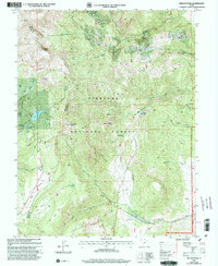
2001 Map of Delano Peak
USGS Topo · Published 2003About this map
Delano Peak and the high ridges of the Tushar Mountains dominate this high-altitude landscape along the border of Beaver and Piute counties. Much of the terrain lies within the Fish Lake National Forest, where the Skyline National Recreation Trail traverses the crest near Mount Holly and Lake Peak. The map reveals a high-country landscape shaped by both recreation and historical industry, with numerous prospects and mines dotting the northern slopes near Alunite Ridge.
Find a feature on this map
52 named features on this map. Tap any name to fly to it.
Don’t see what you’re looking for? This feature index may not catch every label — zoom into the map to look around manually.
Map Details
Editions of this 2001 Delano Peak Map
This is the sole edition of this map. No revisions or reprints were ever made.
Other maps of this area

1885 · Beaver
USGS Topo · 1:250,000

1937 · Delano Peak
USGS Topo · 1:48,000

1943 · Delano Peak
USGS Topo · 1:62,500

1945 · Marysvale
USGS Topo · 1:62,500

1947 · Marysvale
USGS Topo · 1:62,500

1953 · Richfield
USGS Topo · 1:250,000

1958 · Richfield
USGS Topo · 1:250,000

1966 · Circleville
USGS Topo · 1:24,000
1966 · Junction
USGS Topo · 1:24,000
1971 · Circleville Mtn
USGS Topo · 1:24,000