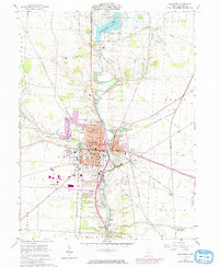
2023 Map of Delaware
USGS Topo · Published 2023About this map
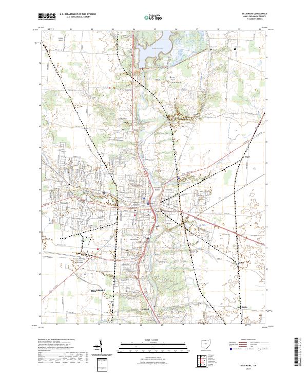
The Olentangy River carves a central path through this survey of the Delaware area, framing a landscape defined by collegiate institutions and water management. The campus of Ohio Wesleyan University sits at the heart of the city, while the Methodist Theological School in Ohio is situated to the south near Stratford. To the north, the expanse of Delaware Lake and its accompanying dam dominate the hydrology, feeding several tributaries such as Sugar Run and Mill Run. The urban grid is dense with local history markers, including the Delaware County Courthouse and numerous burial grounds like Oak Grove Cem and Marlboro Cem. Beyond the city limits, the terrain transitions into agricultural reaches and smaller clusters like West Berlin and Paget, showing the ongoing relationship between the central county seat and its outlying rural settlements.
Find a feature on this map
147 named features on this map. Tap any name to fly to it.
Don’t see what you’re looking for? This feature index may not catch every label — zoom into the map to look around manually.
Map Details
Editions of this 2023 Delaware Map
This is the sole edition of this map. No revisions or reprints were ever made.
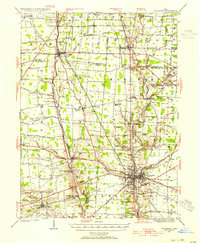
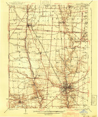
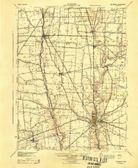
Historical Maps of Concord Township Through Time
5 maps found