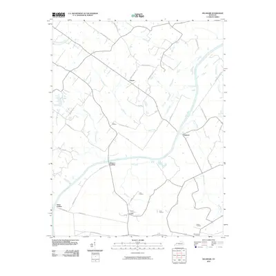
2010 Map of Delaware
USGS Topo · Published 2010About this map
The Green River winds through this rural Kentucky landscape, dictating the placement of small communities and landing points like Quinn Landing and Rangers Landing. This 2010 survey shows a network of local roads such as Griffin and Griffin Rd and Moss and Moss Rd, which serve scattered family settlements and farms. The area is notable for its numerous small burial grounds that offer significant value for genealogists, including Nunn Cemetery, Cobb Cemetery, and Boston Cemetery near the community of Comer. Smaller waterways like Cash Creek and Abe Creek dissect the terrain, feeding into the larger river system. The settlement of Delaware sits near the river bend, while the northern reaches include the place name Euterpe, illustrating the persistent rural character of McLean County in the early 21st century.
Find a feature on this map
40 named features on this map. Tap any name to fly to it.
Don’t see what you’re looking for? This feature index may not catch every label — zoom into the map to look around manually.
Map Details
Editions of this 2010 Delaware Map
This is the sole edition of this map. No revisions or reprints were ever made.
Other maps of this area

1905 · Newburg
USGS Topo · 1:62,500

1906 · Sebree
USGS Topo · 1:62,500

1908 · Calhoun
USGS Topo · 1:62,500

1914 · Henderson
USGS Topo · 1:48,000

1916 · Henderson
USGS Topo · 1:62,500

1949 · Sebree
USGS Topo · 1:24,000

1949 · Robards
USGS Topo · 1:24,000

1951 · Sebree
USGS Topo · 1:24,000

1951 · Robards
USGS Topo · 1:24,000

1951 · Spottsville
USGS Topo · 1:24,000