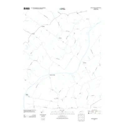
2013 Map of Delaware
USGS Topo · Published 2013About this map
The Green River carves a deep, winding course through this rural landscape in McLean County, anchoring several small settlements and historic river points. In the early 21st century, Delaware stands on the eastern bank while several landing sites like Quinn Landing and Rangers Landing mark the long-standing connection between the waterway and the local economy. The surrounding terrain is a network of small creeks including Lick Cr, Cash Cr, and Abe Cr, which define the drainage patterns for the community of Euterpe and the rural crossroads of Coraville and Niagara. Road names like Mackey Cemetery Rd and Hall School Rd suggest the locations of local institutions that have long served the families in this part of Kentucky. The orientation of the roads, such as Eastwood Ferry Rd, points to the historical importance of river crossings before modern infrastructure arrived.
Find a feature on this map
45 named features on this map. Tap any name to fly to it.
Don’t see what you’re looking for? This feature index may not catch every label — zoom into the map to look around manually.
Map Details
Editions of this 2013 Delaware Map
This is the sole edition of this map. No revisions or reprints were ever made.
Other maps of this area

1905 · Newburg
USGS Topo · 1:62,500

1906 · Sebree
USGS Topo · 1:62,500

1908 · Calhoun
USGS Topo · 1:62,500

1914 · Henderson
USGS Topo · 1:48,000

1916 · Henderson
USGS Topo · 1:62,500

1949 · Sebree
USGS Topo · 1:24,000

1949 · Robards
USGS Topo · 1:24,000

1951 · Sebree
USGS Topo · 1:24,000

1951 · Robards
USGS Topo · 1:24,000

1951 · Spottsville
USGS Topo · 1:24,000