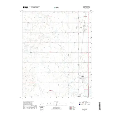
2019 Map of Delaware
USGS Topo · Published 2019About this map
Delaware and Lenapah anchor this northern Oklahoma landscape, where the grid of the Public Land Survey System meets the meandering courses of California Creek and Wolf Cr. The town of Delaware is particularly well-defined, showing a network of named streets including Cereal St, Elevator St, and Cherokee St that reflect its local development and layout. To the north, the small community of Lenapah sits near the eastern edge of the quadrangle.
Find a feature on this map
47 named features on this map. Tap any name to fly to it.
Don’t see what you’re looking for? This feature index may not catch every label — zoom into the map to look around manually.
Map Details
Editions of this 2019 Delaware Map
This is the sole edition of this map. No revisions or reprints were ever made.
Other maps of this area

1901 · Nowata
USGS Topo · 1:125,000

1914 · Nowata
USGS Topo · 1:125,000

1954 · Tulsa
USGS Topo · 1:250,000

1958 · Tulsa
USGS Topo · 1:250,000

1963 · Tulsa
USGS Topo · 1:250,000

1972 · Blue Mound
USGS Topo · 1:24,000
1972 · Elliott
USGS Topo · 1:24,000

1972 · Nowata West
USGS Topo · 1:24,000
1972 · Delaware
USGS Topo · 1:24,000
1972 · Oglesby
USGS Topo · 1:24,000