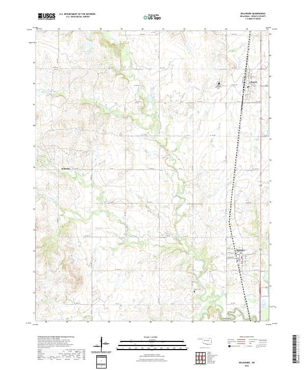
2022 Map of Delaware
USGS Topo · Published 2022About this map
The town of Delaware serves as a primary hub in this portion of Nowata County, showing a detailed street grid including Cherokee St and Elevator St near the local rail corridor. To the north, the settlement of Lenapah is clearly defined, situated where Lenapah Rd meets several residential avenues. The landscape is deeply carved by the winding paths of California Creek and its various branches, which dictate much of the rural road layout. Local history and genealogy researchers will find value in the placement of Mount Washington Cemetery and the more isolated Bezoin-Cem further south. Notable water features like the Glenn Webster Reservoir and the confluence of Mormon Creek near Cedar Bluff provide specific geographic anchors for those studying family land tracts or changing water usage in this Oklahoma prairie region.
Find a feature on this map
57 named features on this map. Tap any name to fly to it.
Don’t see what you’re looking for? This feature index may not catch every label — zoom into the map to look around manually.
Map Details
Editions of this 2022 Delaware Map
This is the sole edition of this map. No revisions or reprints were ever made.
Other maps of this area

1901 · Nowata
USGS Topo · 1:125,000

1914 · Nowata
USGS Topo · 1:125,000

1954 · Tulsa
USGS Topo · 1:250,000

1958 · Tulsa
USGS Topo · 1:250,000

1963 · Tulsa
USGS Topo · 1:250,000

1972 · Blue Mound
USGS Topo · 1:24,000
1972 · Elliott
USGS Topo · 1:24,000

1972 · Nowata West
USGS Topo · 1:24,000
1972 · Delaware
USGS Topo · 1:24,000
1972 · Oglesby
USGS Topo · 1:24,000